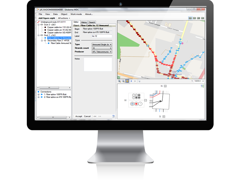
NetStork allows you to:
Display vector map data ( AutoCad – DFX/DWG, Esri Shapefile – SPH)
Display raster map data (BMP, PNG, GeoTIFF)
Import the spatial data and attributes from the AutoCad format (DXF/DWG)
Any coordinate systems are supported with the PROJ4 library support
Display vector map data ( AutoCad – DFX/DWG, Esri Shapefile – SPH)
Display raster map data (BMP, PNG, GeoTIFF)
Import the spatial data and attributes from the AutoCad format (DXF/DWG)
Any coordinate systems are supported with the PROJ4 library support