We’re introducing a number of print map improvements in the app. The aim of these changes is to facilitate the preparation of project documentation…
We’re introducing a number of print map improvements in the app. The aim of these changes is to facilitate the preparation of project documentation…
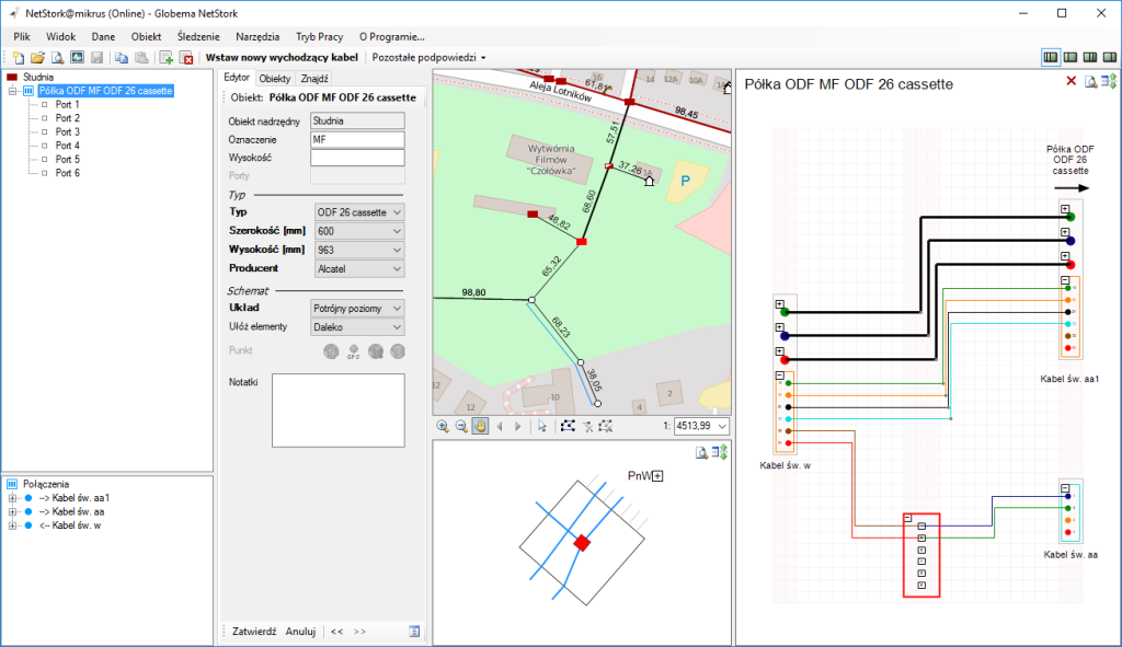
The latest NetStork comes with a completely redesigned graphical user interface.
New version of NetStork comes with the new year 2017. Version 7.0 brings a number of new features and improvements.

At the beginning of the year, we released a new version of NetStork, which includes a number of new features and enhancements.

All attributes can now be edited directly in the NetStork environment.
NetStork now allows you to view map data distributed by WMS (Web Map Service) and WMTS (Web Map Tile Service). With WMS / WMTS services, NetStork can be enriched for example by aerial images, cadastral maps, landuse maps and much more.

© Globema 2024. All Rights Reserved.