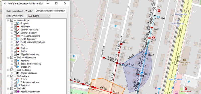
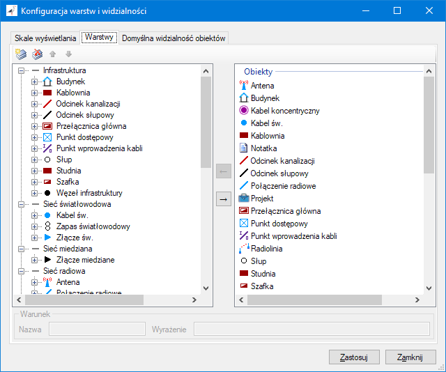
A new possibility has been added to the NetStork app: configuration of layers and their visibility in particular display scales. Thanks to this functionality it is already possible:
- Change the default configuration of layers
- Adding your own layers, containing not only objects, but also primers or groups of map substrates
- Placing objects of the same type on different layers, depending on the value of their attributes (e.g. you can place your own infrastructure on one layer and a foreign infrastructure on another and switch its visibility if necessary).
- Control the visibility of individual layers depending on the current display scale. E.g. hiding detailed data at a long distance, because then their deletion makes no sense anyway, but only slows down map drawing.
Naciśniej na obrazek aby powiększyć
In addition, when display scales were introduced, the configuration of styles was improved in this respect. We introduced it:
- The ability to configure the style depending on the display scale, which allows you to define different styles depending on whether the object is displayed in large or small zoom.
- Controlling style scalability at the level of a single object style rather than globally as before. This allows you to define scalability individually for any object style and for any range of scales.
The latter extension allows, for example, to configure the backlighting style in such a way that the line width remains constant on a large scale and is scalable on small scales, which is the most intuitive behavior, because then the backlight does not disappear at a greater distance and is normally scalable on large close-ups (it increases with map zooming).

